Drone Services
Construction Site Monitoring
2D & 3D Mapping and Surveying Assistance
2D & 3D Mapping and Surveying Assistance
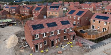
Replace time-consuming manual site walks with rapid aerial surveillance through our drone inspection services. Our drone technology offers real-time updates and detailed aerial photography of your entire site, including hard-to-reach areas like roofs and high structures. With advanced 3D mapping capabilities, Project Managers can make informed, immediate decisions. Additionally, our drone roof inspection and drone thermal inspection services significantly enhance overall site safety, ensuring your project stays on schedule and on budget.
2D & 3D Mapping and Surveying Assistance
2D & 3D Mapping and Surveying Assistance
2D & 3D Mapping and Surveying Assistance
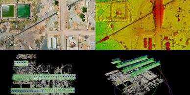
We transform high-resolution imagery captured through aerial photography into accurate, ready-to-use digital assets that seamlessly integrate into your planning and construction workflows. Our deliverables include 2D Orthomosaics for site planning, along with 3D mapping solutions such as 3D Point Clouds and Digital Surface Models (DSMs) for terrain analysis. We also provide precise Volumetric Calculations, including stockpile quantity assessments, enhanced by our drone inspection services. Get centimetre-level accuracy, guaranteed by our rigorous operational discipline.
Inspection Services
2D & 3D Mapping and Surveying Assistance
Inspection Services
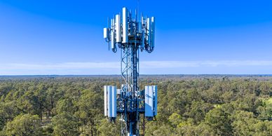
Our CAA-compliant drone fleet quickly provides detailed, high-accuracy assessments of critical infrastructure through advanced drone inspection techniques. We specialise in conducting drone roof inspections, as well as inspecting towers and complex vertical structures, all with unprecedented speed and precision. Utilising cutting-edge aerial photography and 3D mapping technology, we deliver comprehensive data that significantly reduces inspection time, minimizes operational disruption, and accelerates maintenance planning, including drone thermal inspection capabilities.
Thermal Inspection
Missing Person/Pet Searches
Inspection Services
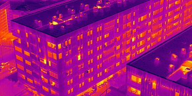
We utilise specialised drones equipped with thermal cameras to perform drone thermal inspections on assets and buildings, detecting issues that are invisible to the naked eye. Our inspection solutions, which also include aerial photography and 3D mapping, effectively locate critical anomalies, such as heat loss, moisture ingress, and electrical faults in solar panels or components. This enables predictive maintenance that protects asset integrity and prevents expensive downtime.
Roof Inspections
Missing Person/Pet Searches
Missing Person/Pet Searches

Eliminate the risk and expense of scaffolding or ladders with our advanced drone inspection services. We utilise high-resolution aerial photography and 3D mapping techniques to perform a thorough, close-visual inspection of your entire roof structure, chimney stacks, and guttering. Our drone roof inspection method provides property owners and managers with precise, auditable imagery to accurately identify defects (e.g., slipped tiles, structural issues) and inform repair strategies, all while ensuring personnel safety. Additionally, our drone thermal inspection capabilities allow for detailed analysis of any hidden issues.
Missing Person/Pet Searches
Missing Person/Pet Searches
Missing Person/Pet Searches
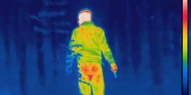
Our drone fleet offers immediate and effective aerial search capabilities for missing persons and pets. By deploying drones equipped with both high-definition cameras and precision thermal imaging, we rapidly scan expansive areas. This critical combination of technology maximises detection probability and delivers real-time intelligence when every minute counts.
Aerial Photography & Videography
Aerial Photography & Videography
Aerial Photography & Videography
Go beyond basic aerial photography and explore advanced techniques like 3D mapping. We provide professional-grade 4K video and high-resolution photography, captured from dynamic, legally compliant perspectives. Our service delivers engaging, high-impact visuals essential for marketing campaigns, property showcases, and commercial feature films. We specialise in producing fluid, cinematic footage that not only captures attention but also creates a powerful, lasting impression.
Emergency Services Assistance
Aerial Photography & Videography
Aerial Photography & Videography
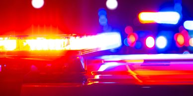
We provide fast, highly compliant aerial support for Search & Rescue operations, incident oversight, and disaster response. Utilising advanced drones—including thermal imaging cameras for drone thermal inspection—we deliver crucial, real-time situational awareness to ground teams. Additionally, our capabilities extend to 3D mapping, aerial photography, and drone inspection, ensuring comprehensive support during critical situations.
Any Other Drone Service
Aerial Photography & Videography
Any Other Drone Service
If your project requires an aerial solution not explicitly listed in our service catalogue—whether it involves 3D mapping, aerial photography, drone inspection, unique access requirements, or challenging environments like a drone roof inspection or drone thermal inspection—we encourage you to contact us.
About Myself

I'm Gavin Hewitt, the founder and chief pilot of GH Aerial Solutions. I live in Ayrshire, Scotland with my wife and two dogs. For 13 years, I have served as a Police Officer, and I currently volunteer as the Officer in Command of 2175 (Rolls-Royce) Squadron, RAF Air Cadets.
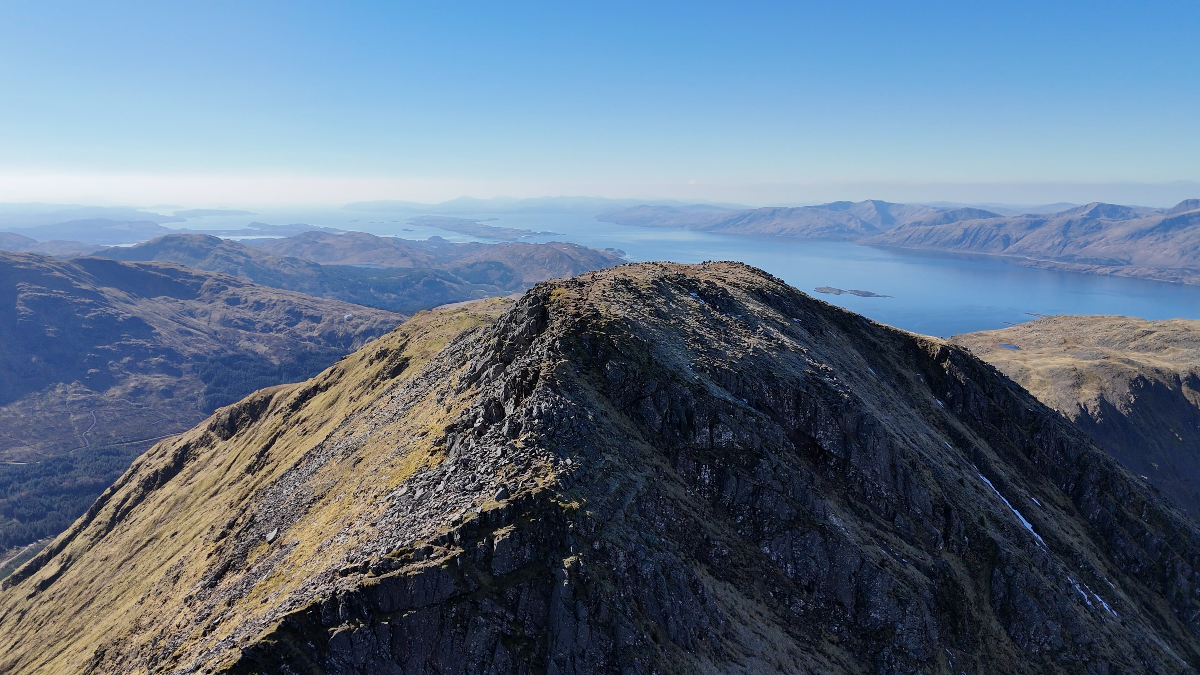
In my spare time, I am a keen hillwalker who loves exploring Scotland. I also enjoy my fitness and recently travelled to Oslo and Amsterdam to compete in Hyrox.
I founded this company to bridge the gap between amateur drone services and the high-compliance needs of the commercial industry. My professional background ensures that every aerial solution—from high-accuracy 3D mapping to drone thermal inspection—is executed with Police-Grade Operational Discipline and unwavering integrity. We also specialise in aerial photography and drone roof inspection to meet various client needs.
Our mission is simple: to provide businesses and organisations with reliable, detailed data and great footage, all collected in the safest, most efficient, and compliant manner possible.
If you have any questions about a complex project or our compliance protocols, please reach out directly. I look forward to assisting you.